Mucuri
Mucuri lies on the Whale Coast, neighbor counties are: Conceição da Barra, Ibirapuã, Nanuque,
Nova Viçosa, Pedro Canário and Serra dos Aimorés.
Population: 35000. Total area: 1774 sq km.
The climate is tropical humid, average temperatures range between 22° C and 31° C in summer and 18° C and 26° C in winter.
The economy is based on agribusiness like eucalyptus plantations and a cellulose plant as well as some other agriculture. Another important factor is tourism.
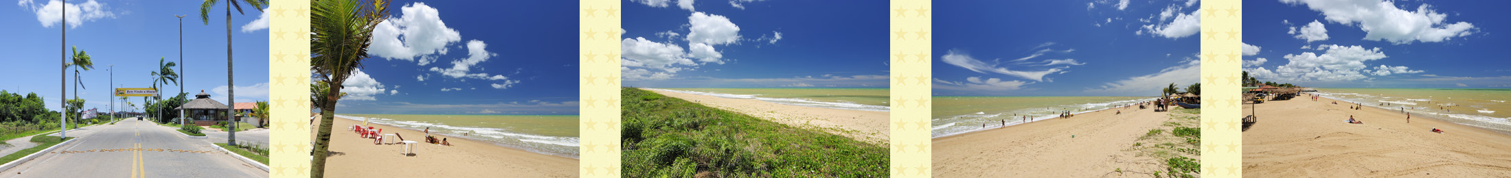
The city has about 35km of beaches, most of them deserted and some with colorful cliffs of amazing heights.
Besides the beaches there are other tourist attractions such as the Ecological Gigica Footbridge, a bridge built over an extensive mangrove.
Through boating and nature trails you can discover the beautiful nature.
Access to Mucuri is by the BR-101 and BA-698.
By air: There are regional airports in Caravels and Teixeira de Freitas.
The nearest international airports are in Porto Seguro, 320 kilometers from Mucuri and another one in Vitória 350 kilometers away.
The beaches of Mucuri:
North of town, coarse sand and strong waves. With a small fishing village.
Long and straight, with strong waves.
On the riverbank Mucuri, deserted and with some vegetation, boat access from Mucuri.
With reefs and mangroves, semi-desert with little infrastructure.
Extensive and semi-desert, with cliffs and golden colored sand. Access is by a dirt road starting from the BR-101, or by boat from Mucuri. There is some infrastructure with inns and beach bars.